
Seattle Address History by Era
Seattle previous residents appear in different sources as one address moves back through time. Current parcels and recorded instruments give the starting frame. Older deeds may require books or microfilm, while property cards and directories help match a structure to people. The table separates title evidence from occupancy clues.
| Source | Years covered | Keeper | Useful evidence |
|---|---|---|---|
| Recorded books and plats | 1853 through July 31, 1991 | King County Archives | Parties, legal description, and instrument. |
| Landmark index | Most records from August 1, 1991 | King County Recorder | Role, type, date, number, parcel, and image status. |
| Property cards | 1937-1972 | King County Archives | Photo, sketch, construction, and parcel changes. |
| Seattle directories | Digital selection 1867-1940; Archives run 1890-1990 | SPL and City Archives | Dated names, addresses, and printed roles. |
| Permit history | Current and legacy systems; older files vary | Seattle SDCI | Construction, project, status, and documents. |
Start with the current parcel even for a much older question. Its legal description can unlock an Archives request when a street name fails. Use the property card and directory together for a mid-century search. For recent years, inspect deeds and permits, but never call a title party an occupant without a second source.
Seattle Parcels Start the Trail
King County Parcel Viewer accepts an address, parcel, condo name, or intersection. A result may show site address, jurisdiction, taxpayer, present use, lot area, levy code, and building count. Save the parcel number and legal description first. Taxpayer and owner labels are property roles, not proof that a person lived there.
The viewer can select several parcels, buffer, measure, toggle layers, and export a set. Those controls help identify a split lot or predecessor parcel. Its lines are approximate, so keep the map date and verify title facts in the recorded instrument.
Trace King County Deeds Backward
The Recorder Landmark system bridges a parcel to its recorded instruments. Search paths include party name, parcel ID, document type, book/page, record date, legal description, and plat. Web images are unofficial. The Recorder supplies copies, while older material belongs in King County Archives.
- Record the current parcel, situs address, legal description, and exact taxpayer or owner role.
- Search Parcel ID in Landmark, sort by date, and open likely deeds or conveyances.
- Copy the recording number, date, type, parties, roles, book/page, legal text, and image status.
- Use conveyance parties to move back. Separate deeds from liens, easements, deeds of trust, and releases.
- When online coverage ends, search plat, block, lot, predecessor parcel, and Archives microfilm.
- Grantor
- The party giving an interest in a recorded instrument.
- Grantee
- The party receiving the stated interest.
- Chain of title
- A dated sequence of recorded transfers tied to the same property.
- Legal description
- Formal parcel wording based on an addition, block, lot, or unit.
Pre-1991 Seattle Deed Records
A missing Landmark result is not the end of a previous residents search. King County Archives holds recorded documents from 1853 through July 31, 1991 and offers microfilm access. Early records may use Auditor terms, an old subdivision, or a predecessor town.
Bring a legal description, parcel clue, names, and a date span. A street address alone may not retrieve a deed. If land changed through a split, merger, or condo conversion, follow the old plat and parcel. Preserve the exact index and years searched.
Access does not stop with the research room. The King County Recorder offers an in-person and mail copy service at 201 S Jackson Street, Suite 204, and can be reached by phone or email when a record belongs in its custody. Archives is the better route for the older books and microfilm described above. State the desired instrument type, date range, parties, and legal description when asking staff for help. A focused request is easier to route than a broad request for every person ever tied to an address.
Note: An empty web result may mark an access cutoff or changed index key rather than the absence of a Seattle deed.
Seattle Property Cards, 1937-1972
King County property cards can connect an address to the structure that stood there. A card may include a photograph, sketch, construction note, parcel number, and segregation clue. It does not guarantee every taxpayer or owner, purchase price, floor plan, architect, or reason for a parcel change.
The Archives cannot retrieve these cards by current address alone. Use the parcel or legal description. Pair a card with a dated directory before naming previous residents, since the card itself may have no occupancy evidence.
Read missing fields as limits, not as blank facts to fill. A card may omit a taxpayer, sale price, builder, or the reason a parcel was segregated. Its photo and sketch can still show whether the structure resembles the one in a directory-era map. Construction notes can explain why an address first appears after a certain year. If the parcel number changed, copy every segregation reference before returning to the deed books.
The Seattle property-history resource sets out local paths through archive records.
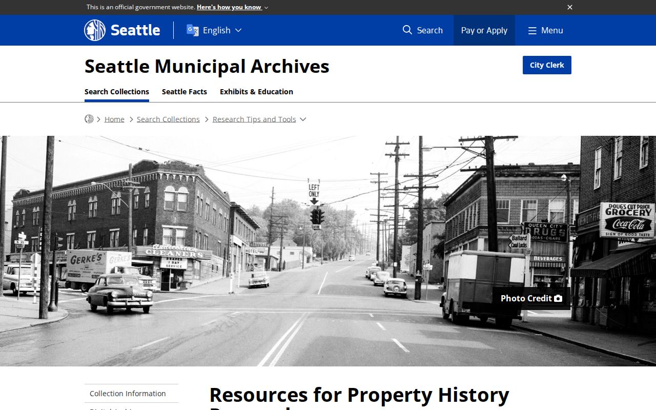
The captured page shows why house history depends on several distinct record series.
Seattle Street Names Can Break
Seattle's 1961 directional-system change and many street ordinances can break a direct address search. City Archives offers pre- and post-1961 Street Designation Maps and an annexation tool. Known examples include De Forest Street to Broadway E, Ballard Broadway to NW Market Street, and 28th Ave E to Empire Way E to Martin Luther King Jr Way.
Search the source spelling first, then the successor name, direction variants, cross streets, and predecessor municipality. Ballard, West Seattle, South Park, Columbia, Ravenna, and Georgetown can require the earlier jurisdiction before annexation. Keep each name and date in the crosswalk instead of silently modernizing it.
Annexation dates can decide which catalog to search. Ballard joined Seattle on May 19, 1907, West Seattle on July 24, 1907, and Georgetown on April 11, 1910. Columbia and South Park joined on May 3, 1907. A person at the same physical place may therefore appear under a predecessor city in one edition and Seattle in the next. Use City Archives ordinance indexes and maps to document that change rather than assuming the directory made an error.
Map the Seattle Building
Sanborn maps, aerials, cards, and permits test whether the same structure stood at the address. A map shows footprint and use, not an occupant. The SDCI Permit and Site History tool accepts an address or map point and draws from current, legacy, and digitized material.
Many electronic files date after January 1, 2006. Older permits may require microfilm, and some plans need a written request. A permit applicant is a project role, not proof of residence. Use the record to date construction, alteration, or demolition that explains a break in the household trail.
The permit-history report can link current zoning, overlays, assessor data, Shaping Seattle, Accela, legacy permits, and digitized plans or documents. Date, type, and keyword filters help isolate work on one parcel. Single-family and duplex plans from before 1974 are generally unavailable through the described electronic path, while most construction plans from 2007 onward require a specific written request with the permit number and address. Record that fallback instead of treating an absent plan as proof that no work occurred.
Seattle Households in Dated Sources
Directories add the occupancy layer that title records lack. The 1928 Seattle House and Street Directory supports reverse address work. SPL has a searchable selection from 1867 through 1940, and City Archives identifies a broader 1890-1990 run. The Seattle directory book collection explains the shelves and entry forms.
Choose one edition and transcribe the address. Follow each name to its alphabetical entry, keep the printed role, and compare the next year. Pair a nearby census or genealogy source when available. Newspapers, obituaries, cemetery records, or probate files can then test a family link, death, or move without collapsing several years into one household.
- Choose one edition and copy the address exactly.
- List each printed name and role.
- Compare the next available directory year.
- Check a census-era or archival household source.
- Corroborate each life event with another dated record.
Lawful use. Research Seattle previous residents for house history, family history, or personal curiosity. Stop at protected addresses and never use the trail to track or harass a living person.
Document Seattle Past Residents
A sound address history states the source, date, record number, role, and access limit for each fact. Label a grantor as a grantor, a taxpayer as a taxpayer, and a directory name as a dated entry. Mark each link as likely, possible, or unproved.
Keep situs, mailing, and return addresses apart. Record parcel changes and old street names. If an image is offline, note the Recorder copy service, Archives microfilm, library shelf, or records request still needed. That audit trail lets another person reproduce the search without overstating who lived here before.
Negative evidence needs the same care. List the spelling variants, editions, index fields, date spans, and access channels checked. A missing 1940 property card can reflect incomplete coverage or a later subdivision. An absent post-1991 index hit can reflect a lag, a different party name, or an unavailable image. The result should say what remains to be checked at the counter, on microfilm, in the Seattle Room, or through a focused public-record request.