
Seattle ZIP Coverage by Area
King County GIS returned 37 codes when its administrative layer was queried for a preferred city of Seattle. That result is a mail-coverage inventory, not a statement that every listed ZIP code lies wholly within Seattle. The compact table groups the codes by useful search area. Neighborhood names are approximate, so an exact address still needs a parcel and jurisdiction check.
| ZIP | Approximate areas | Postal use | Search note |
|---|---|---|---|
| 98101, 98104, 98121, 98122 | Downtown, Pioneer Square, Chinatown-ID, Belltown, Central Area | Standard urban delivery | Expect dense and multi-unit addresses. |
| 98102, 98109, 98112, 98119 | Capitol Hill, Eastlake, Queen Anne, South Lake Union, Madison Park | Standard delivery | Neighborhood lines differ from postal lines. |
| 98103, 98105, 98107, 98115, 98117 | Fremont, Wallingford, Green Lake, University District, Ballard | North Seattle delivery | Check north-city edges by parcel. |
| 98125, 98133, 98155, 98177 | Lake City, Northgate, Broadview, Shoreline area | North-edge delivery | Some coverage reaches outside Seattle. |
| 98106, 98116, 98126, 98136, 98146 | Delridge, Alki, Admiral, High Point, West Seattle, White Center area | West and southwest delivery | 98146 especially needs a city-limit check. |
| 98108, 98118, 98134, 98144 | Georgetown, South Park, Rainier Valley, SODO, Beacon Hill | South and industrial delivery | Use GIS for waterway and industrial parcels. |
| 98148, 98158, 98166, 98168, 98178, 98188, 98198 | Burien, SeaTac, Tukwila, Renton, Des Moines and south-county areas | Regional delivery | A Seattle preferred-city query is not city-limit proof. |
| 98154, 98164, 98195 | Downtown facilities and University of Washington campus | Special-use or institutional | May contain few ordinary household addresses. |
| 98199 | Magnolia and Interbay | Standard delivery | Verify the exact parcel as usual. |
The boundary caution is not minor. Codes such as 98155 and 98158 point toward Shoreline or the airport, while 98195 is tied to the University of Washington campus. A Seattle ZIP code directory should preserve that difference between a standard delivery area and a special-use code. It should also retain the original code on a dated source even when a current postal check gives a different result.
Central Seattle ZIP Code Clues
Central codes can narrow a record fast, but they often contain large buildings and business addresses. In 98104, a Pioneer Square or Chinatown-International District address may have many names in one directory year. In 98121, Belltown redevelopment can make an older address hard to align with a present parcel. The safe unit of comparison is the full address, including a unit or room when the source prints one.
Use the ZIP as a first cut in a newspaper or directory search. Then match the street, year, and building. A person named at a shared address is a dated lead, not proof of current presence. This distinction keeps the ZIP code directory useful even in the densest parts of Seattle.
Find Seattle Residents Within a ZIP
No official King County portal supplies a current resident list for a whole ZIP. Use the postal code to define a likely area, then shift to exact addresses and record roles. The parcel tools accept address or parcel input, and GIS layers can place the point within a jurisdiction. Voter self-service is only for the resident's own record and cannot be used as a block or ZIP-wide directory.
- Copy the ZIP and full address exactly as shown on the dated source. Keep any unit, directional prefix, and street suffix.
- Validate current delivery with the postal lookup, then plot the address in King County GIS. Save the parcel number and jurisdiction.
- Open the assessor record by address or parcel. Treat owner and taxpayer fields as property roles, not proof of occupancy.
- Search a dated directory, newspaper, or other lawful public index with the ZIP and street. Compare the name, date, and exact address.
- Record both sources and label any uncertain match as possible. Do not infer a move from a changed postal code alone.
Once the area narrows to a named road, the Seattle street directory method gives the more precise address workflow. That handoff matters because parcel, permit, and deed tools use an address or parcel rather than a broad postal code.
Seattle Parcel Search Fields
The King County tools do not offer a direct ZIP-only people search. Their observed fields show why an exact-address workflow is stronger. Start in Parcel Viewer or eReal Property, and keep the role labels shown by the source.
| Field or control | Use in a ZIP search | Limit |
|---|---|---|
| Address | Turns a mail-area lead into a mapped point. | Historic spelling may differ. |
| Parcel number | Links assessor, GIS, deeds, and archives. | Numbers can change after parcel actions. |
| Condo name | Helps locate a unit complex within a code. | Does not identify an occupant. |
| Intersection | Frames a street segment in Parcel Viewer. | Still needs a target parcel. |
| Jurisdiction and levy code | Tests whether the parcel is in Seattle. | Not a neighborhood label. |
| Buffer and export | Captures nearby parcel IDs for map work. | Parcel lines are approximate. |
The King County assessor screen shows the address and parcel entry points used after a ZIP narrows the area.
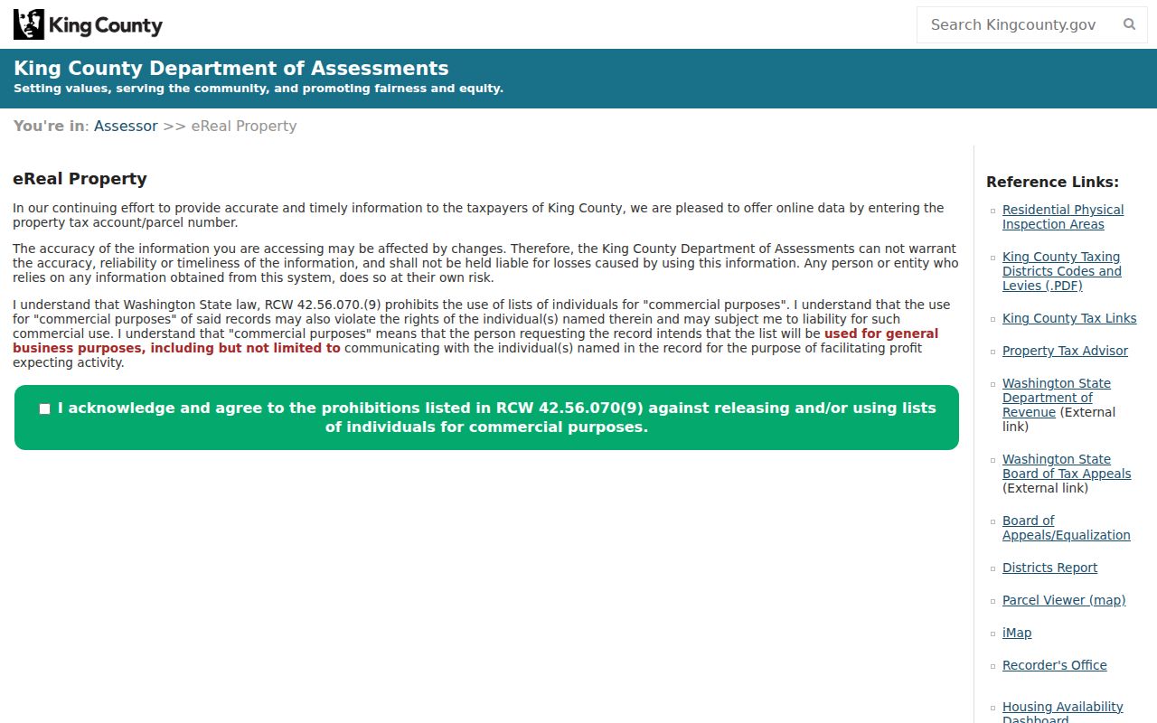
The screen reinforces the key step: move from the postal code to a precise parcel before drawing a conclusion about place or person.
North Seattle ZIP Boundary Checks
North-end searches need extra care around 98133, 98155, and 98177. Broadview and the north corridor meet Shoreline mailing areas, while a neighborhood name may span a different shape from both the postal code and the Seattle limit. Plot the actual address and read the jurisdiction returned for the parcel.
For an old record, also check annexation and street-name material. A present postal label cannot settle which municipality held the record at an earlier date. Keep the record's original place text and add the current map interpretation as a separate note.
Note: A preferred mailing city, a community name, and a municipal boundary may describe three different geographies for one Seattle-area address.
Seattle Special-Use ZIP Codes
Codes 98154 and 98164 serve special downtown delivery areas, while 98195 is associated with the University of Washington campus. These codes can appear in public records without representing a typical residential block. Search the named facility, full address, and dated source rather than assuming that a household exists within the code.
This is a useful Seattle geography lesson. A ZIP can be designed for mail routing to one institution or a limited set of recipients. The code is still valid evidence that the source used that delivery route, but it says little by itself about residency.
West and South Seattle ZIPs
West Seattle codes such as 98116 and 98136 overlap familiar community names, but the letter W in a street prefix often points to Magnolia or Queen Anne, not West Seattle. Keep street direction and postal geography in separate fields. In the south, 98108 and 98134 include industrial and Duwamish-area parcels where a mailing address may describe a site, firm, or facility rather than a home.
Codes 98146, 98168, 98178, and nearby south-county codes are poor substitutes for the city boundary. White Center, Tukwila, Burien, SeaTac, and Renton-area mail coverage can enter the result set. King County GIS and the exact parcel jurisdiction resolve that ambiguity far better than a Seattle mailing label.
Seattle ZIPs Versus City Limits
Postal service areas are built to route mail. Seattle city limits are municipal boundaries. Neighborhoods are community or reporting labels. Those systems often overlap, but none can replace the others. The city publishes census-based Community Reporting Areas, King County maps parcels and administrative layers, and postal tools validate delivery. Use the system that matches the question.
An address that looks like Seattle but falls in 98146, 98155, 98158, 98166, 98168, 98178, 98188, or 98198 deserves a parcel check. The result may be outside the city even when Seattle appears as a preferred mailing city. A ZIP code directory must state that mismatch plainly so readers do not attach the wrong court, permit office, or historical jurisdiction to a record.
- ZIP code
- A five-digit postal delivery area that can cross local government lines.
- ZIP+4
- The base code plus four digits that narrow delivery to a smaller segment, building, or group.
- PO-box ZIP
- A code assigned mainly to post-office boxes instead of ordinary street delivery.
- Unique ZIP
- A code assigned to a large organization or facility with enough mail to warrant its own route.
- Carrier route
- A delivery path within a postal area, not a city or neighborhood boundary.
Historic Seattle ZIP Code Evidence
A historic document should be transcribed as it appears. Preserve the ZIP, old street name, prefix, unit, and date even if current tools cannot validate the string. Seattle changed its directional street system in 1961, and many segments were renamed by ordinance. A modern postal correction can erase the clue needed to find the old directory entry.
Next, build a crosswalk. Check City Archives street designation maps, the relevant directory year, an old map, and the present parcel. Search an annexed predecessor municipality when the date requires it. Ballard, West Seattle, South Park, Columbia, Ravenna, and Georgetown joined Seattle at known dates, so record custody and place labels can shift while the building remains in the same physical spot.
Note: Keep the original ZIP and the current interpretation in separate fields so later researchers can reproduce both searches.